Matching the Technology to the Task: An Overview of Surveying Solutions
Surveying extends beyond merely collecting data on elevation, position, or the Earth's topography. It is a critical process that creates a comprehensive and detailed representation of the terrain, informing a multitude of applications, including defense, infrastructure engineering, and environmental stewardship. The accuracy of this data is paramount, directly determining the success and safety of any resulting project.
Diverse solutions for every project
- Engineering and Construction: Foundational planning for transportation routes, bridges, urban developments, and industrial facilities.
- Urban Planning: Essential for land use management and the creation of detailed zoning maps.
- Resource Management: Vital for monitoring forests, water bodies, and mineral deposits.
- Environmental Analysis: Used for impact assessments and natural disaster forecasting.
Executing these tasks effectively necessitates the use of specialized surveying technologies and equipment.
SURVEYING EQUIPMENT
Among the many tools available, Total Station, GNSS, Digital Levels, and GIS devices play crucial roles, each offering distinct advantages and applications.
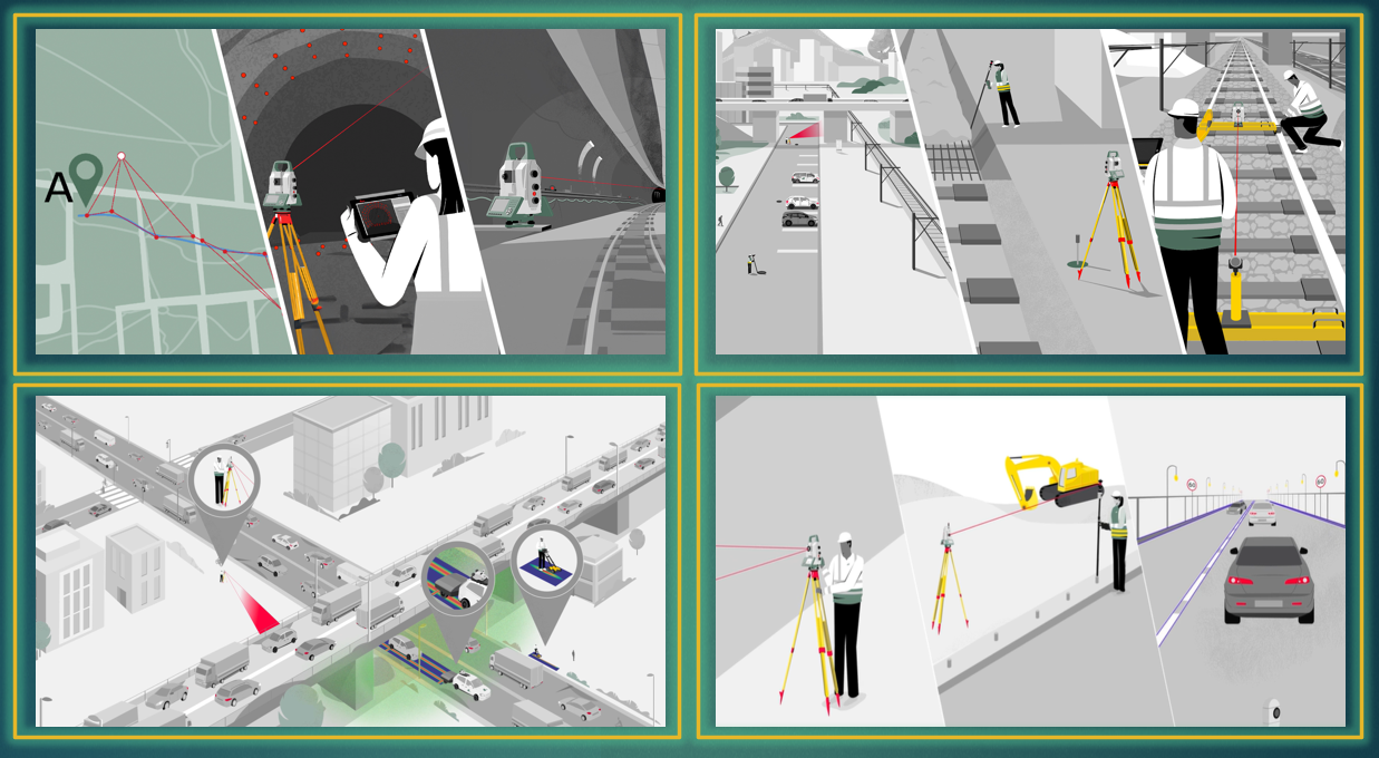
1. Total stationA versatile instrument that integrates angle and distance measurement capabilities. It is essential for a wide range of surveying tasks in construction, infrastructure, and tunneling projects. | 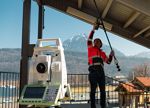 |
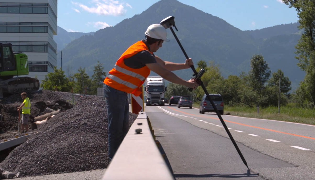
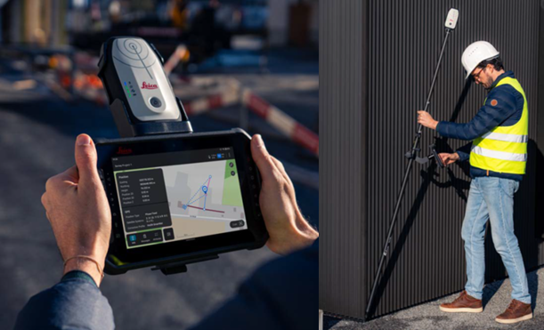
2. GNSS Smart Antenna
A high-precision positioning device that delivers millimeter-level accuracy. Its primary uses include establishing geodetic control networks, conducting cadastral and large-scale topographic surveys, or guiding automated machinery.
3. Digital Levels An advancement from traditional optical levels, the digital level utilizes barcode-staff auto-reading technology to significantly enhance precision and efficiency. It is widely employed for monitoring structural settlement and deformation (buildings, bridges, dams), creating elevation plans for site grading, and verifying slopes during construction. | 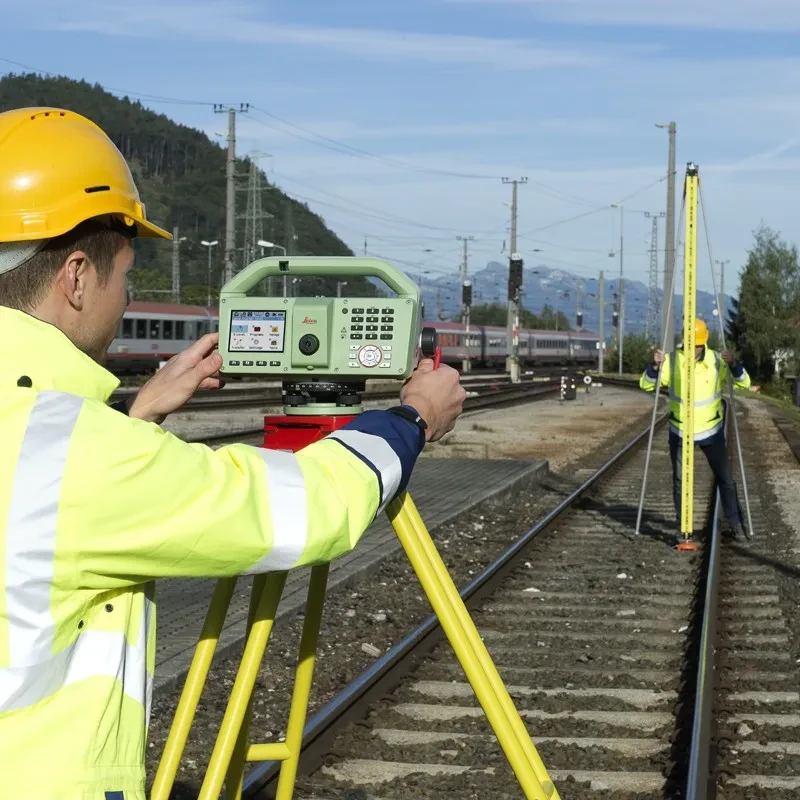 |
4. GIS device
This compact handheld combines GNSS positioning with GIS functionality, enabling users to collect, view, edit, and manage geospatial data directly in the field. Common applications include asset management, environmental monitoring, agricultural planning, field inspections, and disaster response support.
OTHER SPECIALIZED EQUIPMENT
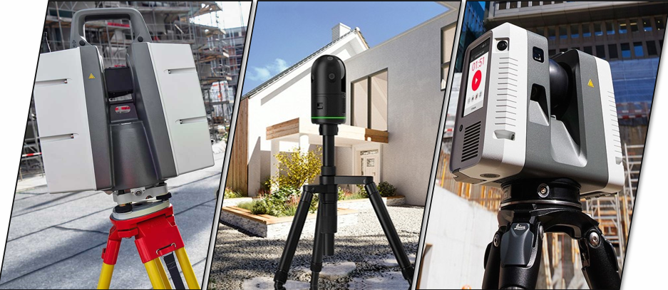
1. Terrestrial laser scanner
These devices emit laser beams to collect millions of data points, creating a dense point cloud.
They are used for Building Information Modeling (BIM), conducting as-built surveys, assessing construction deviations against design specifications, volume calculations, and heritage preservation.
2. Aerial laser scanningThis method utilizes Unmanned Aerial Vehicles (UAVs) equipped with advanced sensors, such as LiDAR and high-resolution cameras, for large-scale aerial surveying.
It is particularly effective for projects involving difficult-to-access terrain, expansive mapping, and volumetric analysis. |  |
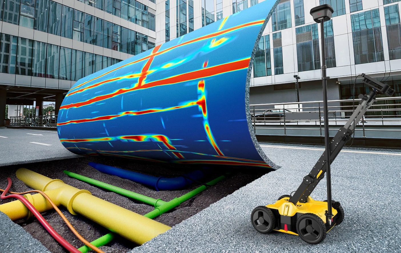
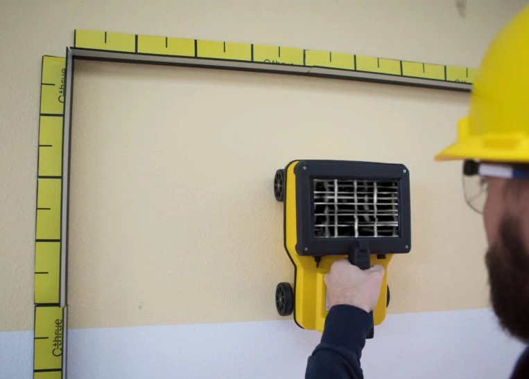
3. Detection systems
Crucial for risk mitigation, these systems identify underground utilities before construction begins. Using technologies like Ground-Penetrating Radar (GPR), this equipment detects and visualizes subsurface features. Its primary applications include mapping underground infrastructure, assessing the integrity of concrete structures, and pinpointing the location and depth of buried utilities like cables and pipes.
4. Railway survey equipmentSpecialized instruments provide railway-specific surveying technologies. They are vital for assessing existing track conditions, guiding new track construction, and performing routine rail maintenance. | 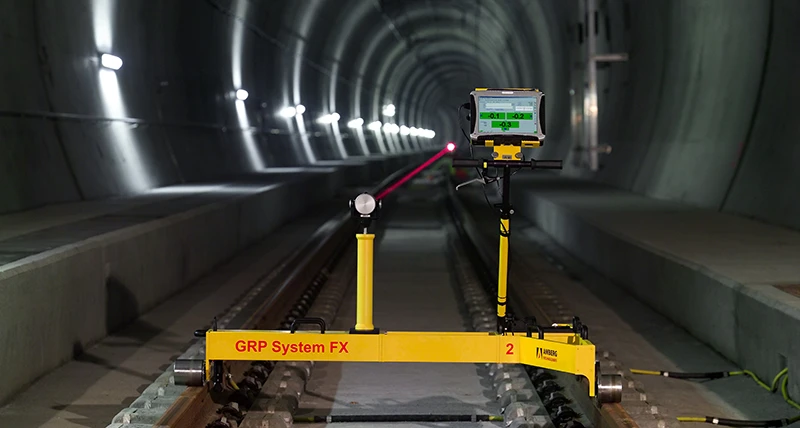 |
The flexible integration and deployment of these technologies not only boost productivity but also deliver exceptional accuracy for every project. Ultimately, selecting the equipment that precisely matches the unique requirements of each task is the key to achieving optimal results and efficiency.
SISC VIETNAM INSTRUMENTATION JSC is the pioneer and market leader in Vietnam’s surveying and geospatial solutions sector. For years, we have provided clients nationwide with the world's most advanced surveying products and technologies, building an unwavering reputation for reliability and excellence.
With a Leica Geosystems-authorized technical service center, we ensure that every piece of cutting-edge equipment is backed by a global-standard warranty, comprehensive maintenance, and expert technical support.
From topographic surveys and infrastructure construction to resource management and environmental monitoring, SISC Vietnam is the trusted partner dedicated to keeping your projects precise, productive, and on track.
Keywords: Total stations, GNSS Smart Antenna, Levels, GIS devices, Railway survey equipment.