AIRBORNE DATA ACQUISITION TECHNOLOGY: A BREAKTHROUGH IN THE GEOSPATIAL WORLD
As a cornerstone of Industry 4.0, airborne data acquisition has evolved into a critical enabler of digital transformation across diverse sectors. Leveraging a spectrum of platforms—from agile Unmanned Aerial Vehicles (UAVs) to sophisticated sensor-equipped aircraft—this technology is fundamentally reshaping the paradigm of geospatial intelligence. It moves beyond simple observation, empowering organizations to capture, process, and analyze spatial information with unprecedented speed and accuracy, thereby converting raw data into actionable insights for strategic decision-making.
1. Airborne Sensor:
Aerial surveying technology utilizes both manned aircraft and UAVs equipped with specialized sensors such as optical cameras, LiDAR, thermal cameras, multispectral, and hyperspectral sensors, etc to collect information about the Earth’s surface. The collected data then undergo complex processing to produce valuable geospatial products.

Key technologies:
- Global Navigation Satellite System (GNSS): Provides precise positioning data for the aircraft and sensors.
- Inertial Measurement Unit (IMU): Measures and tracks the aircraft’s orientation and angular velocity to calibrate the collected data.
- Optical sensors: Capture high-resolution imagery to create 2D and 3D models of the survey area.
- LiDAR sensors (Light Detection and Ranging): Use laser pulses to measure distance, creating a detailed 3D point cloud of terrain and objects.
- Multispectral / Hyperspectral Sensors: Collect data on object reflectance across various spectral bands, enabling analysis of material composition and condition (e.g, crop health, mineral types)
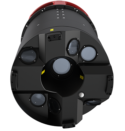
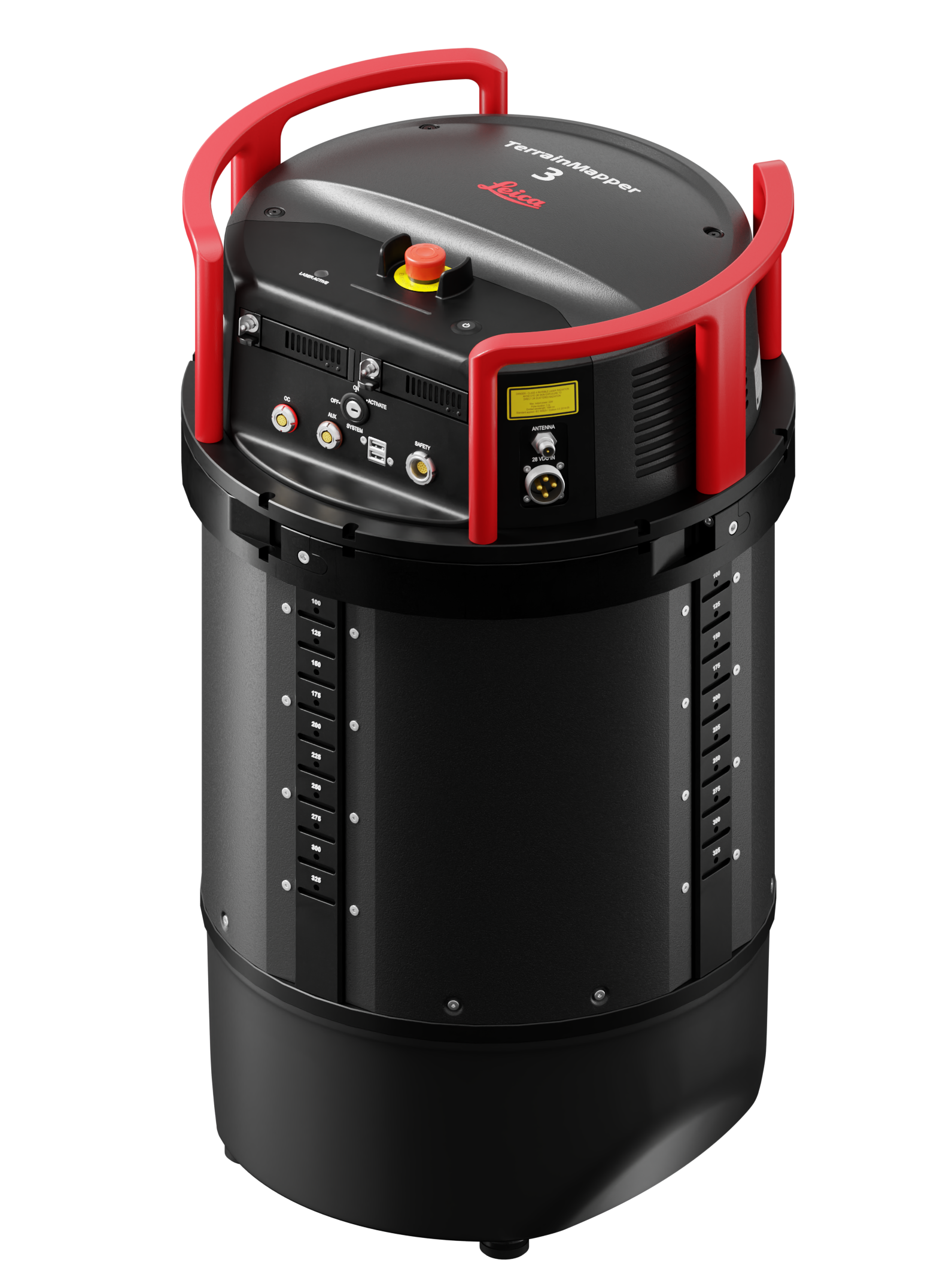
Hybrid sensors
Specialized airborne sensors mounted on aircraft feature advanced LiDAR and Imaging technology. They are designed for large-scale data acquisition from the air, producing high-accuracy deliverables for national mapping, defense, urban planning, digital twin, and infrastructure management.
Compact laser scanning droneAutonomous laser scanning drones offer a compact design for easy 3D data collection from the air. Integrating autonomous flight, LiDAR, SLAM technology, and obstacle avoidance, they simplify workflows with unprecedented accuracy and ease.
These devices are ideal for architectural and construction surveys, asset management, and heritage preservation. | 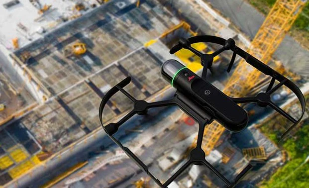 |
2. Key Deliverables:
Raw data from aerial surveys is processed to create a range of high-quality geospatial products.
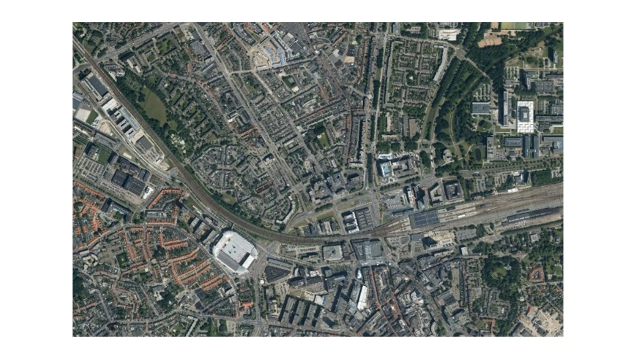
- Orthophoto Mosaics: Orthomosaic of a large area with high precision in coordinates and scale. It is the basis for many mapping and GIS applications.
- True Ortho Imagery: An enhanced version of Orthophoto, calibrated to eliminate tilting of tall buildings (e.g, unobstructed side views of buildings).
- DEM - Digital Elevation Model and DSM - Digital Surface Model: representation of the bare ground topographic surface of the Earth (DEM) or surface elevation including objects (DSM), crucial for planning, hydrology, and construction.
- 3D Point Clouds: Collection of millions or billions of points with X, Y, Z coordinates, detailing the shape and location of all objects in the survey area. LiDAR point clouds are exceptionally detailed.
- 3D Models: Generating high-fidelity 3D models of buildings and other features, widely used in urban planning, virtual tourism, and asset management.

- Thematic map: Maps displaying specific information, such as land use, crop distribution, or resource allocation, derived from multispectral/hyperspectral data.
3. Diverse use cases:
Airborne data acquisition technology enables new efficiencies acros many sectors:
- Urban Planning and Infrastructure Management: Base mapping, current-state assessment, utility network management.
- Smart Agriculture: Monitoring crop health, managing irrigation and fertilization, detecting pests, and estimating yields.
- Forestry: Forest resource inventory, wildfire monitoring, biodiversity assessment, and sustainable forest management.
- Construction and Project Monitoring: Pre-construction topographic surveys, progress monitoring, earthwork volume calculations, and structural safety inspections.
- Resource Exploration & Mining: Geological surveys, mineral prospecting, and mine mapping.
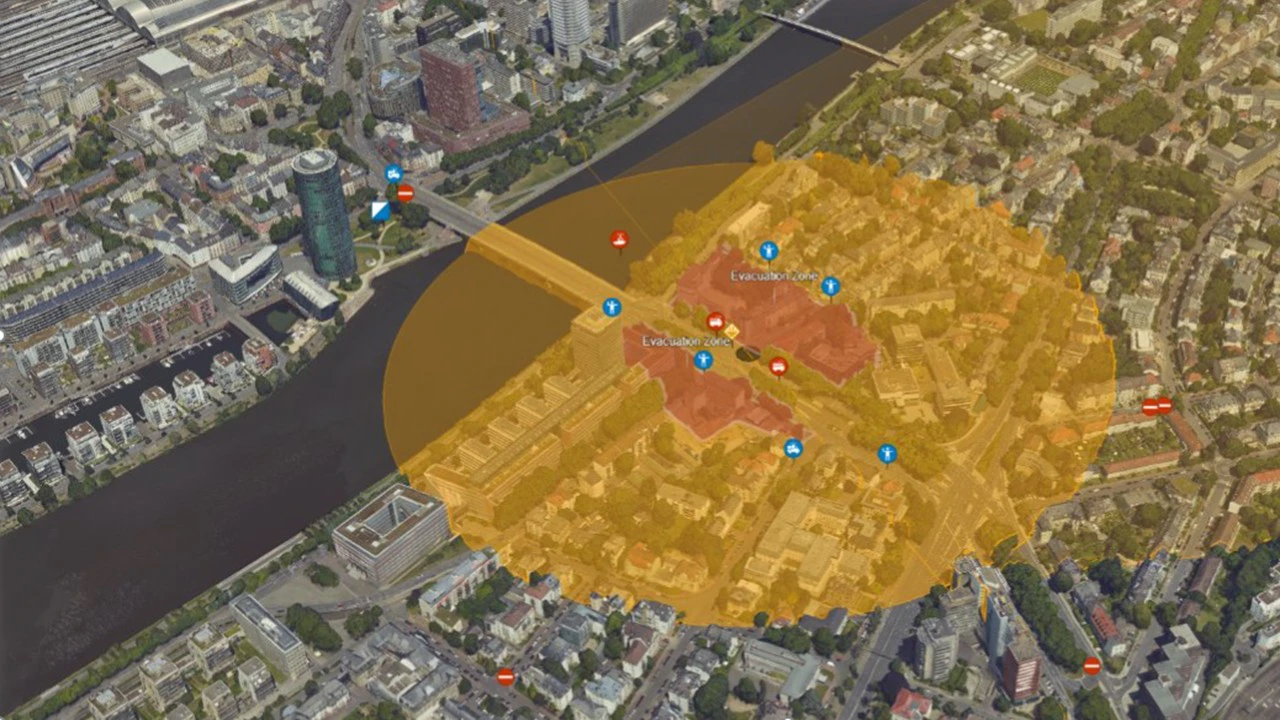
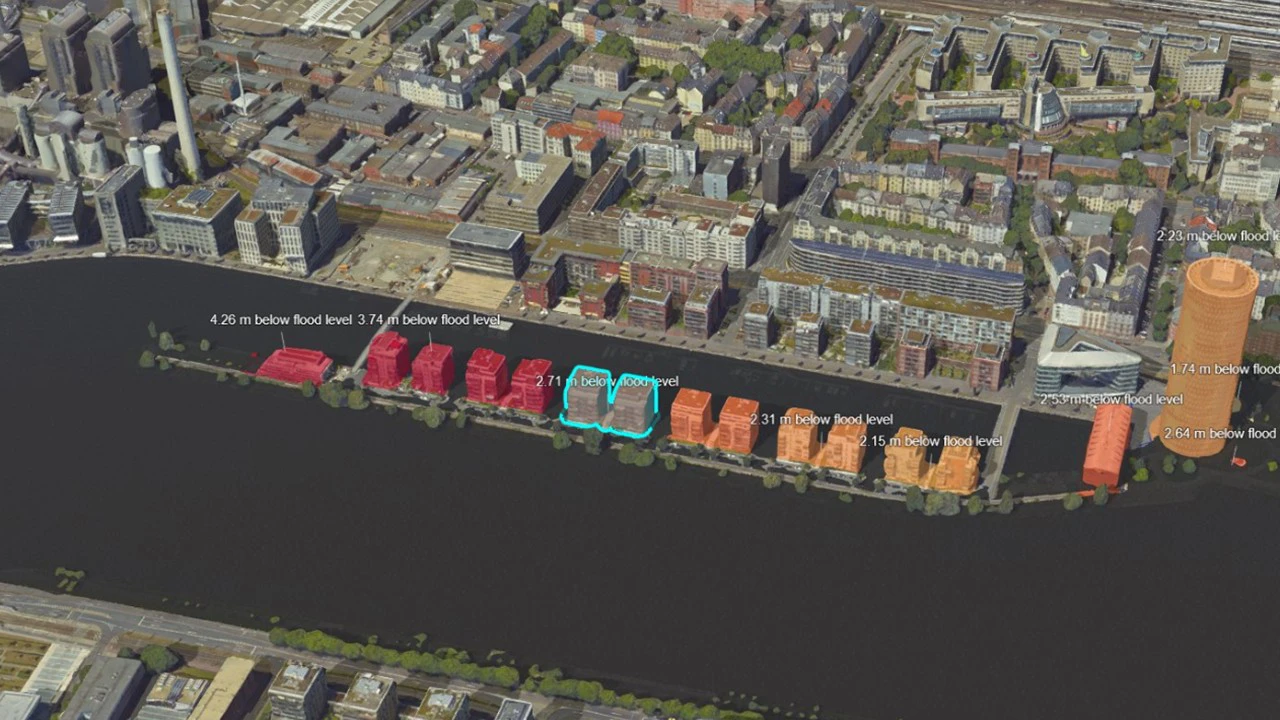
- Disaster Management & Emergency Response: Damage assessment after floods, earthquakes, or wildfires; mapping affected areas to support rescue and reconstruction.
- Heritage Preservation & Archaeology: Creating 3D models of historical structures.
- Defense: Strategic mapping, border surveillance, and intelligence support.
5. Superior Advantages:
Compared to traditional methods, aerial surveying offers significant benefits:
- High Efficiency and Speed: Rapid data collection over large areas, significantly reducing project timelines.
- High Accuracy: The output product offers superior coordinate and geometric accuracy for many demanding fields.
- Safety: Minimize human risk when surveying hazardous terrain or large areas.
- Cost-Effectiveness: Optimizes costs, especially for large-scale projects, compared to ground-based surveys.
- Rich, Detailed data: Provides a comprehensive and detailed overview, including information difficult to obtain otherwise.
- Flexible Accessibility: Enables surveying of areas that are difficult or impossible to access on the ground.
- Frequent Update: Easily conduct periodic surveys to stay informed and track changes.
Airborne data acquisition is no longer a futuristic concept but a present-day imperative for solving complex geospatial challenges. By delivering high-precision data with unprecedented speed, this technology drives smarter decision-making, enhances operational efficiency, and paves the way for sustainable development across every industry.
As a pioneer in Vietnam, SISC Vietnam Instrumentation Joint Stock Company harnesses this transformative power. We deliver end-to-end aerial intelligence solutions, from initial survey design to final data analysis. Partner with the nation's leading experts to unlock the most advanced and reliable solutions, tailored specifically to your project's demands.
Keywords: Airborne Sensor, CityMapper-2, Terrain Mapper, BLK2GO