Reality Capture Solutions for Every Application
In the era of digital transformation, converting the physical world into precise, actionable data has become essential. Reality-capture technology is the cornerstone of this revolution, enabling the creation of high-fidelity 3D models of our surroundings. Far more than mere archival records, these datasets unlock a wealth of possibilities for analysis, simulation, design, and lifecycle management.
A versatile range of 3D laser-scanning solutions that meets every user application.
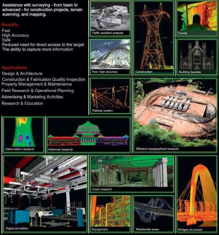
Applications in many fields
Robust Hardware
1. Laser Scanners
We offer a full spectrum of laser scanning solutions, from entry-level to professional-grade. These systems deliver dense point cloud data with exceptional accuracy, making them ideal for applications that demand high detail and reliability, including engineering projects, industrial plant management, construction QA/QC, and even forensic investigation.
- Versatile: A diverse range of solutions to serve various applications.
- High Accuracy: Capture point cloud data with millimeter-level precision.
- Rapid: Significantly reduces time compared to traditional survey methods.
- Safe: Enables remote data acquisition, minimizing risks for personnel in hazardous environments.
- Comprehensive: Captures all objects and the entire scene, preventing data loss.
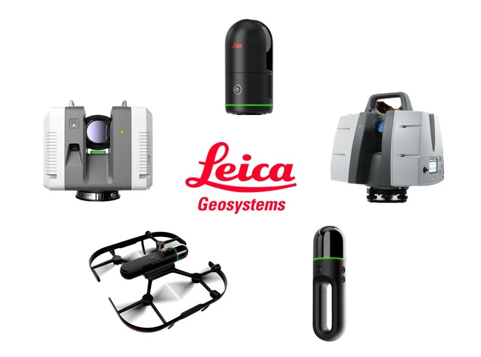
Leica Geosystems laser scanning devices
2. Mobile Mapping Systems
Mobile mapping systems are the optimal solution for large-scale data acquisition across areas such as transportation corridors (e.g., roads, railways) and complex urban environments.
Designed for mounting on vehicles like cars or trains, these systems integrate a powerful combination of LiDAR sensors, high-resolution cameras, and a GNSS/IMU positioning unit. This synergy allows for the capture of a continuous and highly accurate stream of data while the vehicle is in motion.
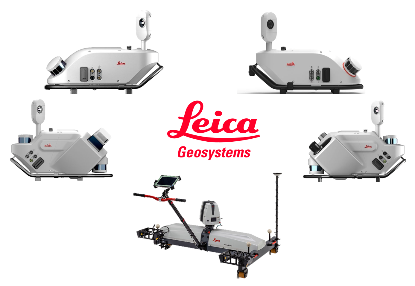
Leica Geosystems mobile mapping solutions
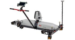 | Leica SiTrack – a purpose-built rail-based mobile mapping solution. The system is engineered to roll effortlessly on the rails, streamlining track-inspection and maintenance workflows. Powered by survey-grade 3D point-cloud data and a comprehensive suite of rail-specific software tools, SiTrack strengthens on-site safety while maximising operational efficiency. |
Leica Pegasus TRK – a versatile mobile-mapping solution for any project. Engineered for quick mounting on vehicles such as cars or trains, the system’s integrated GNSS, LiDAR, and imaging sensors automatically capture survey-grade 3D point-cloud data. This powerful, flexible tool is ready to meet even the most demanding specifications | 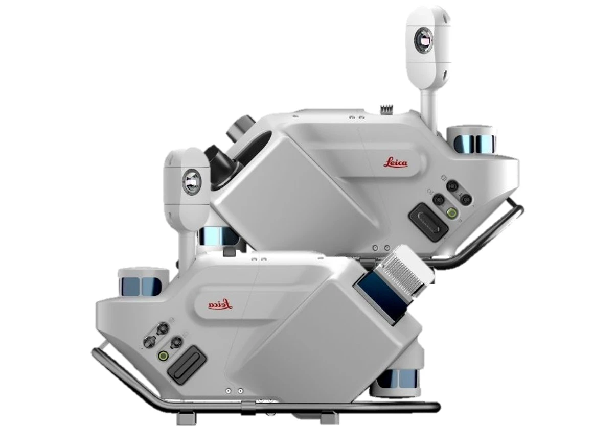 |
Intelligent Software
The power of this solution lies not only in the hardware but also in its seamless software ecosystem. Users of the laser scanning equipment are provided not just with the hardware, but also with the accompanying software and technical support that come with the laser scanner..
Field Software
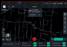
Specialized field software engineered for on-the-go data capture. It supports project planning, device management, and real-time scan viewing so you can track exactly what has already been recorded.
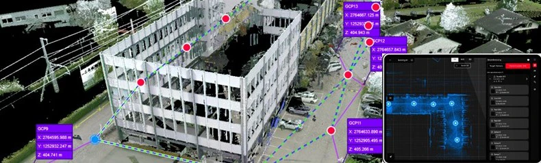 |  |
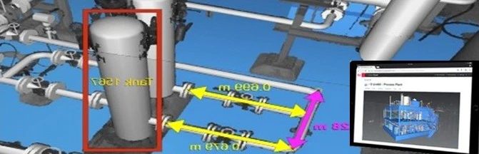
Point cloud data processing software A leading point-cloud data-processing solution featuring a diverse suite of modules that delivers an end-to-end workflow for any point-cloud project in 3D laser scanning, surveying, construction, and related applications. Users can exchange data freely with other software platforms, giving them full access to as-built digital information anytime, anywhere. | Plug-in software A plug-in that lets users work efficiently with point-cloud data directly inside third-party platforms such as AutoCAD, Revit, etc., supporting a wide range of applications - from 3D digital mapping and BIM to Smart City development. Users can freely combine the host program’s native tools and commands with the plugin’s full set of extra commands and features without any compatibility issues. |
 | 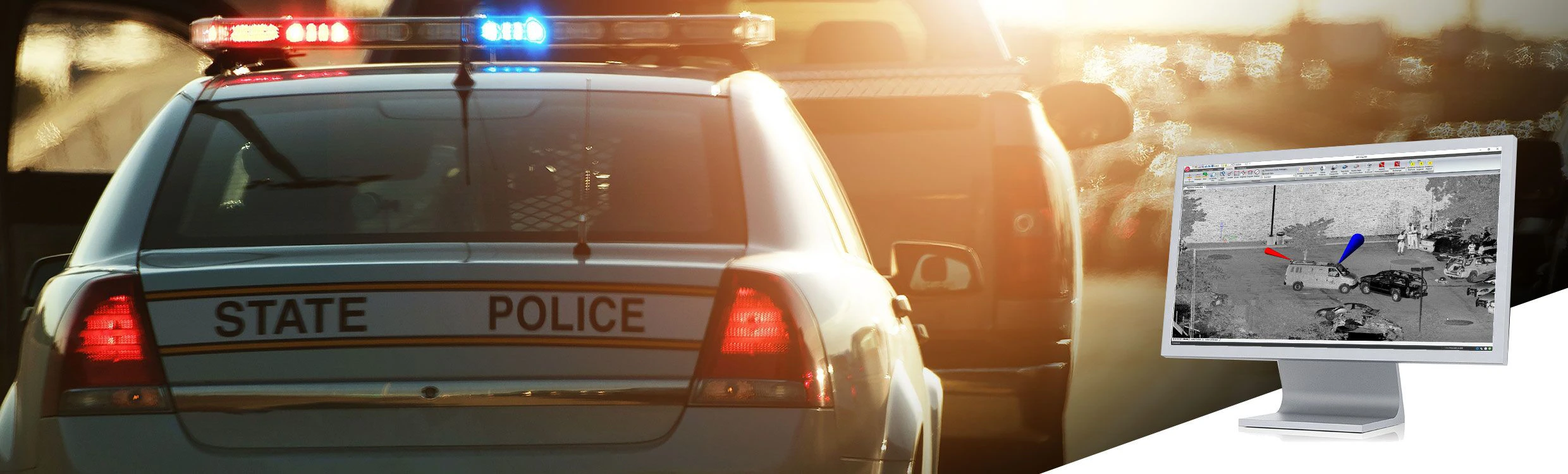 |
3D-point cloud data sharing software Point-cloud data-sharing software that makes working with point clouds, design models, annotations, and more easy and intuitive. Its outputs give anyone on the project the most convenient way to access, view, analyze, and collaborate on digital data. | Forensic Software Specialized software solutions for drawing and reconstructing accident and crime scenes – designed to process, analyze, visualize, and produce courtroom-ready deliverables quickly and easily. The software can import data from various sensors such as scanners, total stations, and GNSS to create precise 2D or 3D diagrams and animations. |
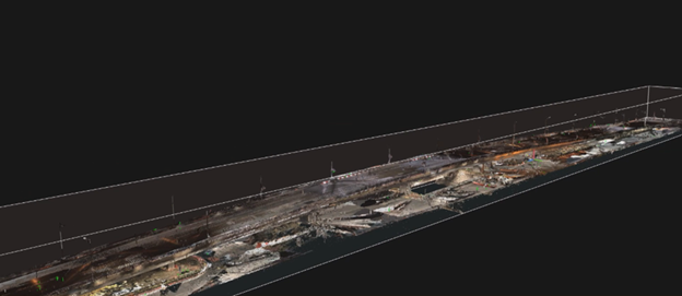
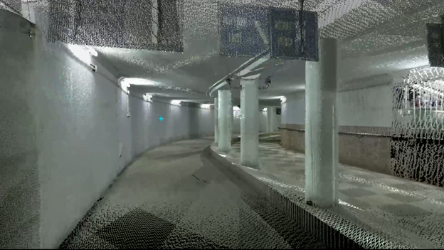
3D Scan data of Trần Duy Hưng overpass, Hà Nội
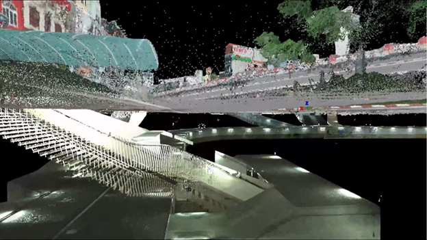
3D Scan data of Ngã Tư Sở, Hà Nội
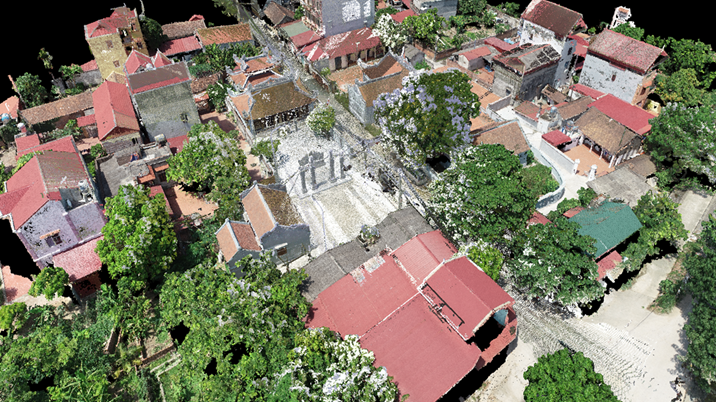
Point cloud data of Như Nguyệt Temple.
Leveraging years of specialized experience in monitoring and 3D data acquisition, SISC VIETNAM is uniquely positioned to advise on and deliver solutions tailored to the specific demands of each project.
Our commitment is upheld by a team of expert technicians, certified to international standards, who are dedicated to providing exceptional service and unwavering support for our clients.
Keywords: Leica Scanner, Mobile Mapping, RTC360, P50, BLK2Fly, BLK2GO, Leica SiTrack, Leica Pegasus TRK.